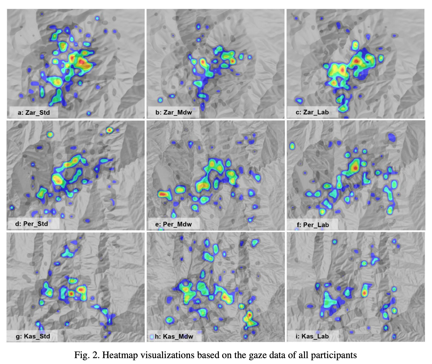
Abstract Eye tracking recordings could reveal the visual behavior for different carto- graphic visualization techniques, such as hill-shading, while at the same time eye track- ing metrics (ETMs) can summarize the associated complexity levels in a concise and quantitative manner. In the present study, three different hill-shading methods, including: (i) the standard method based on ideal diffuse reflection, (ii) the Multidirectional Oblique- Weighted method – MDOW and (iii) the combination of a MDOW’s variation with stan- dard hill-shading, are evaluated and ranked in terms of their perceived visual complexity. The performed examination is based on both eye tracking techniques and expert judgement procedures. A weighted combination of basic ETMs has been used, implemented by the Landscape Rating Index – LRI. The weights resulted from an experts’ judgement process where the opinions of experts in geoinformatics, cartography, geovisualization, experimen- tal psychology, cognitive science, neuroscience and eye tracking were analyzed. Fifteen (15) individuals participated in an eye tracking experiment with hill-shading images produced by the three methods under evaluation, while 41 experts participated in an online questionnaire in order to collect all the analysis data. The final evaluation was based on the computation of three LRI models. The outcomes indicate that implementing hill-shading with more than one light sources results in similar perceptual behaviors, allowing for a seamless exploita- tion of the advantages of using multidirectional illumination.
Full citation (dataset) with DOI Tzelepis, N., Krassanakis, V., Kaliakouda, A., Misthos, L.-M., & Nakos, B. (2020). MDHScomplexity (Version v1) [Data set]. Zenodo. https://doi.org/10.5281/zenodo.14680770
Related articles Tzelepis, N., Kaliakouda, A., Krassanakis, V., Misthos, L. M., & Nakos, B. (2020). Evaluating the perceived visual complexity of multidirectional hill-shading. Geodesy and Cartography, 69(2), 161-172. https://doi.org/10.24425/gac.2020.131085
http://users.ntua.gr/niktzel/gc_paper_data.zip