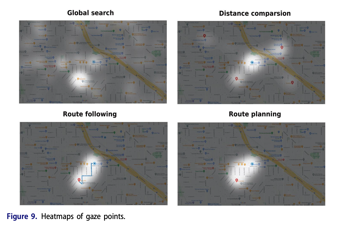
Keskin M, Krassanakis V, Çöltekin A. Visual Attention and Recognition Differences Based on Expertise in a Map Reading and Memorability Study. ISPRS International Journal of Geo-Information. 2023; 12(1):21.
Krassanakis, V. (2022). Examining the preattentive effect on cartographic backgrounds utilizing remote mouse tracking. Abstracts of the ICA, 5, 111. (EuroCarto 2022 Conference). https://doi.org/10.5194/ica-abs-5-111-2022
Qin, T., Fias, W., Van de Weghe, N., & Huang, H. (2024). Recognition of map activities using eye tracking and EEG data. International Journal of Geographical Information Science, 38(3), 550–576. https://doi.org/10.1080/13658816.2024.2309188
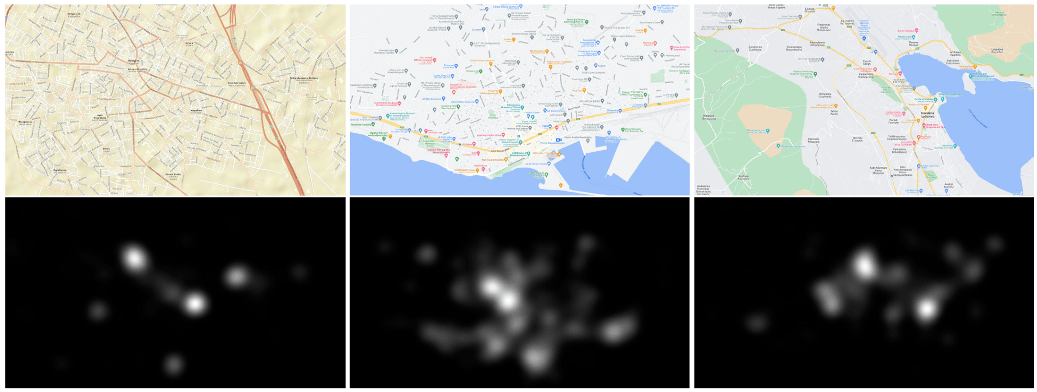
Liaskos D, Krassanakis V. OnMapGaze and GraphGazeD: A Gaze Dataset and a Graph-Based Metric for Modeling Visual Perception Differences in Cartographic Backgrounds Used in Online Map Services. Multimodal Technologies and Interaction. 2024; 8(6):49. https://doi.org/10.3390/mti8060049
Related articles
Keskin M, Krassanakis V, Çöltekin A. Visual Attention and Recognition Differences Based on Expertise in a Map Reading and Memorability Study. ISPRS International Journal of Geo-Information. 2023; 12(1):21.
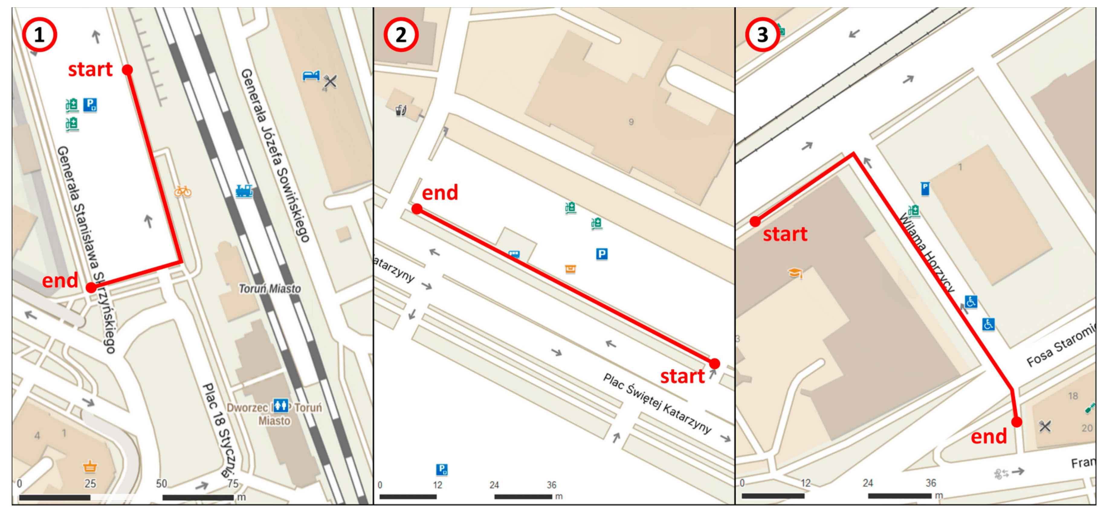
Horbiński, Tymoteusz, 2024, “Efficiency and accuracy in locating symbols within diverse spatial contexts on mobile maps using eye-tracking technology on the example of the Mapy.cz”, https://doi.org/10.7910/DVN/DZUFJ1, Harvard Dataverse, V1
Related articles
Rymarkiewicz W, Cybulski P, Horbiński T. Measuring Efficiency and Accuracy in Locating Symbols on Mobile Maps Using Eye Tracking. ISPRS International Journal of Geo-Information. 2024; 13(2):42. https://doi.org/10.3390/ijgi13020042